
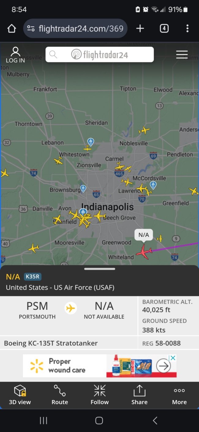
I just discovered a cool website; www.FlightRadar24.com You can track any aircraft, in real time anywhere on the planet by tail number, flight number, or location. Yesterday we had a low flying helicopter tracking back and forth over our county all day and I was looking for information on it. Turns out it contracted by SoCal Gas Co to sniff for methane gas leaks in their distribution system using green Lidar.

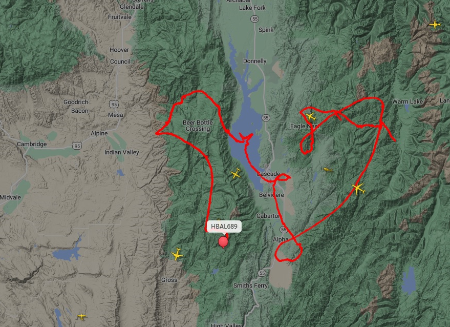
But while I was looking to see where it might be today I discovered something interesting; high altitude Helium Balloons operating up to 63,000' and being steered.

These flight paths are typical of all of them. The one below V is the one at the far left of the image above.

This one near Sioux City

Here is a discussion fron 2022 that mentions them > https://forums.radioreference.com/threads/hot-air-balloon-at-60-000-ft-in-north-carolina.442351/
And here is a link to what they are, and who makes them. But nothing about what they are doing... https://aerostar.com/products/balloons-airships
Turns out they operate in "constellations" of two or more, and are used to track thunderstorms... or so they say.

But while I was looking to see where it might be today I discovered something interesting; high altitude Helium Balloons operating up to 63,000' and being steered.
These flight paths are typical of all of them. The one below V is the one at the far left of the image above.
This one near Sioux City
Here is a discussion fron 2022 that mentions them > https://forums.radioreference.com/threads/hot-air-balloon-at-60-000-ft-in-north-carolina.442351/
And here is a link to what they are, and who makes them. But nothing about what they are doing... https://aerostar.com/products/balloons-airships
Turns out they operate in "constellations" of two or more, and are used to track thunderstorms... or so they say.


 ). I can only imagine it got me confused with the GPS transceiver on a plane that passed overhead (I was running right by an airport).

